After WWII, two factors caused the Thai government to hurry the nationwide transport development. The first one was the strategic factor in order to prevent the spread of communism which was growing stronger and had intimidated many countries of South East Asia. All countries of the region were struggling against the communists and trying their best to protect Democracy.
The second factor was agriculture for export purposes. This followed the National Social and Economic Development Plan 1-4 (1961-1981) which aimed to change the production policy from subsistence agriculture to producing for sale and to meet the markets demand as well as to support industrial growth (another sector that the government was encouraging its growth). The industries listed were processed agricultural production such as rice mills and sugar processing plants. These factors led to the governments development of infrastructures to aid the expansion of agriculture and industry production by expanding the roads to connect the suburbs with the city as well as connecting the regional areas to the capital.
Besides adding convenience to the spread of administrative power into the areas taken over by the Communist Party of Thailand and their movements from the neighboring countries, the new roads constructed were used to transport crops planted for trade to enter the market easily and fill the export orders.
The northern region of Thailand is an economic crops plantation. The National Social and Economic Development Plan 1-4 (1961-1981) placed Chiang Mai, Lamphun and Lampang as the center of economic growth by setting up a development paths for the northern region. The paths were to spread the income and improve the production structure by focusing on the poor rural areas and the areas of the city with economic problems or high unemployment. The goal was to help them by providing aid for agricultural projects and teach them to efficiently use their resources as well as finding new resource sources along with developing their agriculture and agro-industry production.
By initiating the development plan, rapid growth and development was introduced into the northern areas in many ways, such as brining in agricultural technology to increase the amount of production, for example newer species of plants were introduced, usage of scientific fertilizer, pesticide and machinery along with constructions of irrigation canals and roads and highway improvements to speed up the transport of crops from the fields to processing plants and exporters.
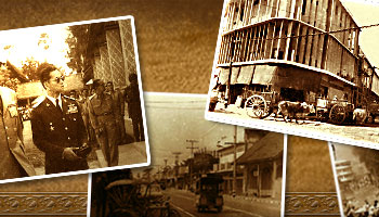
The governments policy of expanding the roads was carried out continuously even after the rail had arrived in Chiang Mai in 1921. The plan was postponed due to the out break of WWII. The early stages of roads built included wagon trails in the highlands for ox caravans, ox cart tracks in the plains and roads in the city area. After the war, the demand for production growth increased and cars were used more as transportation so the government had to boost the transport development by establishing the Chiang Mai Highway District Office opposite the Maharaj Nakorn Chiang Mai Hospital to control the road constructions in Chiang Mai.
In 1952, The government passed the State Highway Construction Act, for 88 state Highways to be finished in 4 years (1952-1955). 18 of those were to be constructed in the north for example the road from Chainat Province to Kho Kha District, Lampang Province
Thoen Li Lamphun
Rong Kwang Ngao
Fang Chiang Rai
Lamphun Lampang
Mae Chaem Mae Hong Son
Many other roads were repaired and expanded for example,
Chiang Mai Hod
Chiang Mai San Kamphaeng
Chiang Mai San Sai
Chiang Mai Chiang Dao Fang
Chiang Mai Lamphun
During 1967-1987 major roads of the north that were completed and improved were as follows:
1. The roads completed were such roads as
1969 Chiang Mai Lampang (No. 11) and Chiang Mai Hod
1970 Nakhon Sawan Chiang Rai
1976 Chiang Mai Chiang Rai
2. In 1980 dirt district connection roads were improved as follows:
The Maerim and Samoeng roads.
The road from Ban Mae Malai, Mae Taeng Distric, Chiang Mai to Pai District , Mae Hong Son
3. During 1986-1988 the road connecting Pai District and Mueang District, Mae Hong Son Province was built
4. During 1978-1987 the improvement of major roads in Chiang Mai connecting the outer Districts such as Omkoi, Mae Chaem, Mae Wang, Phrao and Samoeng was done as well as constructions of roads from districts to farther out villages and villages in the mountains.
The development for convenient transportation routes affected the economic system both in trade and production. It caused the trade structures to change opening an opportunity for the villages and the city to exchange goods and the city to exchange their goods with Bangkok easily through the road webs throughout the country.
One following effect in building the road connections between cities was the construction of bus terminals around the city of Chiang Mai for it to become a transport center among the nearby cities. The terminals for example, the Chang Phueak Bus Terminal on Chotana Road was the first one built in Chiang Mai. It served as the transportation center between Chiang Mai and the northern communities of Mae Rim, Mae Taeng, Chiang Dao, Fang and Thaton.
References
Anu Noenhad, Pol. Lt. Col. (2003). Sang Khom Mueang Chiang Mai Lem 5(Chiang Mai Society vol. 5). (in Thai). Chiang Mai:
Nopburi Printing.
______________ . (2005). Prawat chumchon nai Mueang Chiang Mai (Sang Khom Chiang Mai Lem 10) (the history of communities in Chiang Mai (Chiang Mai Society vol. 10)).
(in Thai). Chiang Mai: Nopburi Printing.
Chusit Chuchart. (1995). Kad Nguo (talad nguo) : Miti Nueng Khong Kan Sathon Khwam Plieanplaeng Khong Sangkhom Chaona Nai Phak Nua Khong Prathet Thai (The Local Cattle Markets: A Dimension of Reflection of the Peasantry in Northern Thailand.
(in Thai). Chiang Mai: Rajabhat Institute.
Plaiao Chananon. (1986). The roles of merchant capitalism in the rise and expansion of capitalism in Northern Thailand, 1921-1980.
(in Thai). Thesis for Master of Economics, Chulalongkorn University.
Chiang Mai University Library
Chiang Mai
ntic@lib.cmu.ac.th
Chiang Mai University. Information Technology Service Center
Chiang Mai
itsc@itsc.cmu.ac.th
Chiang Mai University, Funder
Usanee Thongchai, Advisor and project expert
1952
image/jpeg(.jpeg .jpe .jpg)
1 photo; black & white; 8x10 inch.
BS-CM-RD103
Saving or printing of all photos or contents are allowed only for research or study purposes. For other purposes, contact the Chiang Mai University Library for permission.


)